Do you know the way to San Jose?
Posted by Neil in Jog Le Blog on May 29th, 2009
Yes……..and now I know the way to John O’Groats too.
Drove the 670-ish miles to JOG in the ridiculously undersized van today.
Another fact from the book of the bleeding obvious was realized today: Scotland is a big place.
This became apparent when were 30 miles from Glasgow and it dawned on me that we hadn’t yet covered half the distance.
We could have been forgiven for thinking we were actually driving somewhere abroad today: 670 miles and not a single hold up in traffic. Who’d have thought?
The journey wasn’t entirely without incident: some moron with a trailor had 2 unsecured dustbin sized plastic bins in the back.
At 70mph they got caught by the draft, left the comfort of the trailor and bounced once on the road before one of them hit the bonnet of the van before arching gracefully in the air before landing on (and completely trashing) the windscreen of a car travelling behind.
The driver bid a hasty retreat at the next exit without going back for his bins - but not before we got his number.
The bonnet of the van now has a nice dent in it. If that has to come out of the deposit then the number plate is going in this blog.
The last 300 miles today was along the same route we are going to cycle along (in the other direction). There are two pretty awful bits, but all in all it doesn’t look too horrific (famous last words).
The weather today has been fantastic, and the scenary spectacular. Driving along the lochs, and along the coastline between the sea and the mountains was something else.
I imagine if the weather is not so pleasant on the return journey it could be a very different story.
Tomorrow we bid farewell to Andrew (Petes brother) who will be driving the van back and leaving us well and truly stranded up here.
The rest of the day is ours to do as we please (might cycle the 10 miles to the Northern most point, might take a ferry to the islands, might do both) before Sunday mornings pedal-off.
I Know It’s Gonna Happen One Day…………
Posted by Neil in Jog Le Blog on May 28th, 2009
……..Sunday to be exact 
We had our final ride yesterday: 20 miles to give the legs a bit of a stretch.
Roger has done an outstanding job on my bike - the man is like a surgeon.
New chain (old one was 75% worn), new brakes, cables adjusted, new pedals, bearings greased, and other things I’m not even going to pretend to understand.
The difference it has made to the bike is pretty substantial: changing gear just happens….immediately (previously there was a 2-3 second delay while the bike thought about it) and silently. The brakes actually slow the bike down when I pull them (a novelty I’ve not yet got over). When I’m cycling along it no longer sounds like I’m dragging a bag of spanners along with me. Lovely stuff.
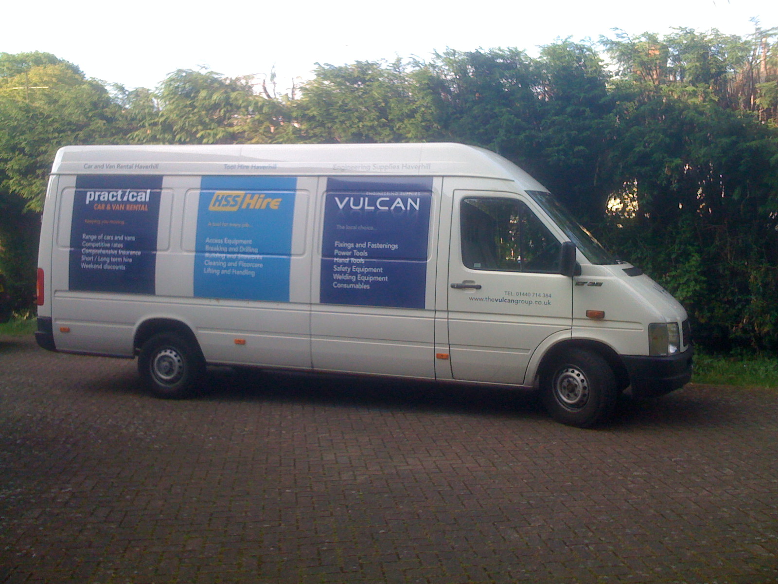
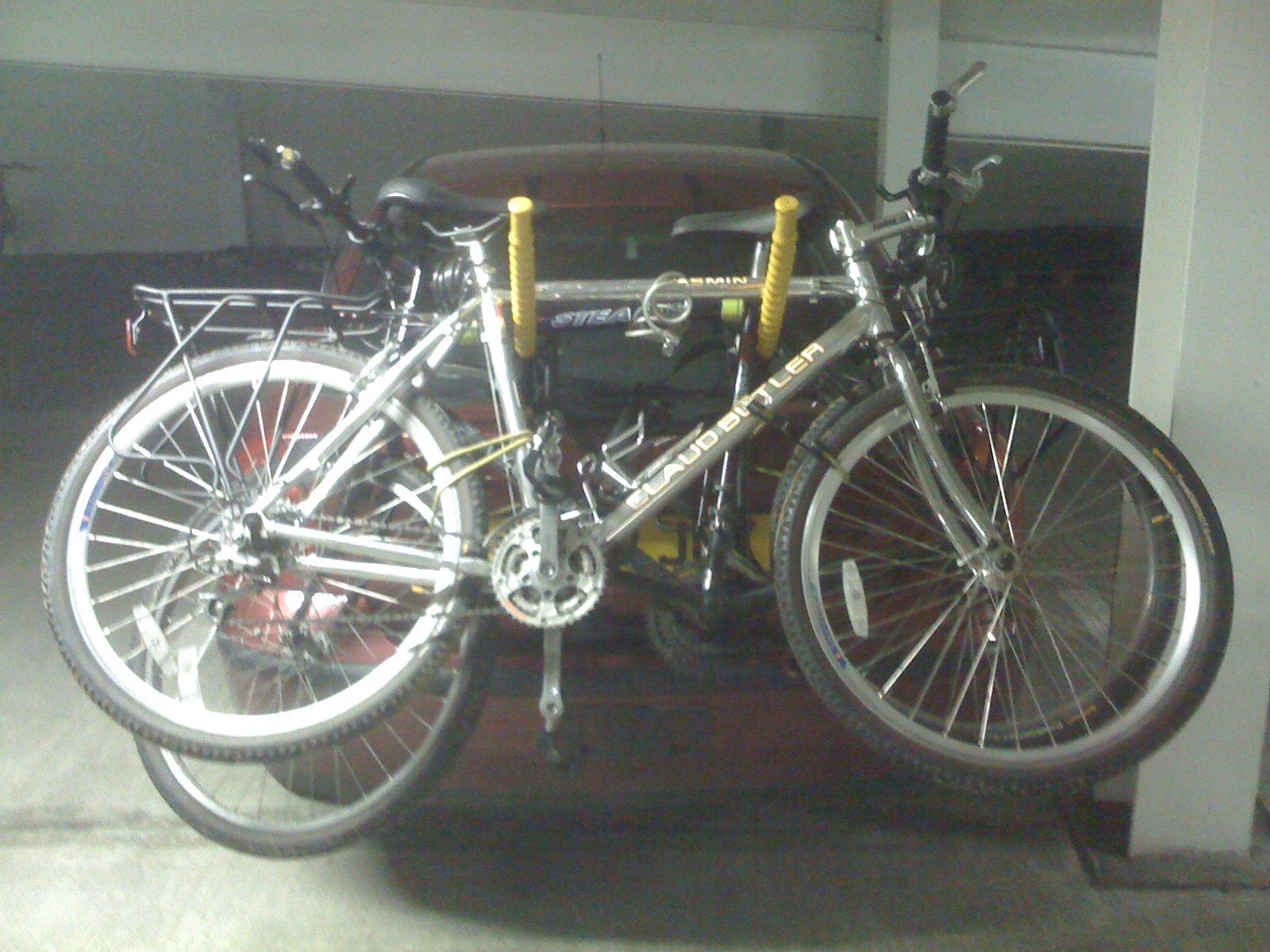
We’ve picked up the van ready for tomorrows 650 mile drive - I’m not going to say anything about its suitability for the job…..I think the photo says it all.
I finished mapping out the route about half an hour ago (it’s 9:00pm as I type this)……..that’s not sloppy planning……just planning timed to perfection.
I think the bikes will fit in the back……….
Hmm…..interesting…..
Posted by Neil in Jog Le Blog on May 15th, 2009
So yesterday we thought we’d better actually start thinking about the route we are going to take.
We decided quite a while ago that we would go John O’Groats to Lands End rather than the more common Lands End to John O’Groats route.
This was largely for 2 reasons:
1. By travelling from the top of the country to the bottom we will surely be going “downhill”….at least in our heads anyway.
2. Scotland=mountains. We want to get that out the way first, rather than cycle several hundred miles knowing that Scotland was still to come.
We have convinced ourselves that our plans need to be far more rigid in Scotland compared to the rest of the journey because the area is pretty sparse - finding accomodation ‘off the cuff’ may be a problem. So with that in mind we have now mapped out our first 5 days and have booked the first 4 nights accomodation in B&Bs along the route.
In a nutshell, we will follow the eastern coastline from John O’Groats down to Inverness, then head South West by following the Lochs - including the length of Loch Ness (need to check we can upload our Nessie sightings to YouTube) - before dropping down to the outskirts of Glasgow via Loch Lomond.
It only took us 7 hours to plan/book the Scotland leg of the journey (Google Earths flight simulator can be so distracting)
The views can be pretty spectacular on a nice day, so we will obviously be needing our waterproofs and full fingered gloves for the first few days of the ride.
Once we leave Scotland the schedule becomes far more relaxed. It is our intention to make a decision each day around the early afternoon mark about how many more miles we feel like cycling that day, and then book somewhere to stay accordingly (what can possibly go wrong with this approach?).
We have mapped out a rough route that we will follow - including a nice big chunk of the Welsh coastline - to get an idea of the distance we will be cycling.
The details of the route south of Scotland still need to be ironed out a little, but it looks like the ride is going to be in the 1,100 - 1,150 miles range (gulp).
There’s just two weeks to go now, so we have decided to ease off the long rides and stick to 30-40 mile rides. I think (hope!) I’ve found the setting on the GPS to stop the stupid thing recalculating the route when we go off it - we’ll test this out on Sunday when we cycle a 40 mile Cambridge loop. I’m hoping that it works as it would be nice to not cycle an additional 10-15 miles every day due to my uncanny knack of not being able to pay attention.
All that’s left to sort out now is for me to get my bike checked over/serviced by Roger - a man who knows a thing or two about bikes and cycling.
To put it into perspective, if I was to compare my cyclist rating to being in a band, my band would be driving itself from dodgy pub to dingy club playing 3 chord songs on pretty shoddy equipment.
Roger on the other hand, well he’s sold out 5 nights at Wembley Stadium being supported by The Stones.
I just hope he doesn’t point and laugh for too long.
TO THE MOON……………
Posted byNeil in Jog Le Blog on May 11th, 2009
…well……it seemed we cycled that far to me
So yesterday we cycled (and completed) the Painters Trail on a very nice warm sunny day.
Total distance cycled: 85 miles (yep: EIGHTY FIVE - a personal best for both of us).
The more attentive reader will have noticed that in an earlier entry I said the trail was 70 miles long, and that we would be taking a GPS……..so how could there possibly be such a discrepancy?
Read on…………
The trail is a very big loop (well actually, a figure of 8 but who’s taking notes?) so you can join it at pretty much any point. When I cycled part of it last year I went to the ‘official’ start point in Manningtree - only to be left emotionally scarred by the days events. A new start point was in order: Long Melford seemed as good as any.
So we get there, park up and take the bikes off the car. A cursory glance at the map and we both agree that we need to head back along the route we had driven, taking a left at the outskirts of the village. So off we set.
A few miles on and things are not adding up - we cannot find the bridge over a river, so cannot take the left immediately after it and drop down onto the old railway track. More cycling back and forth follows along with much staring at the map and GPS screen.
Then the penny drops - we have gone in the completely wrong direction and left the route almost immediately after setting off.
Say hello to the second track of our movie soundtrack CD: The Laurel & Hardy Theme Tune.
The GPS unit has recalculated the route (but assumes we are in a car - more of this later) and so is no longer showing the Painters Trail route that I have loaded into it. The unit can recalculate in a few seconds, so if I don’t happen to be looking at the screen while it’s doing it…………well hilarious consequences are guaranteed.
So we re-trace our steps back to the car, clocking up 8.1 miles, and start “again” (like any form of exercise it’s very important to warm up the muscles before starting in earnest………so really this was not an act of stupidity but a very sensible thing to do………………….no…..we weren’t buying it either).
So off we go on the UNDULATING trail (author of the C2C notes: you could lean a lot from this pal) through many picturesque villages and stuff. The route is based almost entirely on narrow back roads - often single track - with the odd bridleway thrown in for good measure.
We had a few wrong turns, but nothing too drastic until we’d left Polstead. With little or no signposts around we simply could not work out whereabouts we were. The map of the trail wasn’t detailed enough for us to be sure, and the GPS was giving us a similar problem. In the end, we decided to pick a village further along the route and get the GPS to navigate us there where we would pickup the route again.
So that is what we did, and that is what happened. But with the benefit of hindsight………….
The GPS calculates the fastest route to the desination……..by car. So it chose A-roads which we duly cycled along. Whilst cycling along these roads I began to have my doubts, and when we reached our destination I checked on the map to confirm my suspicions.
Had we stayed on the route, the distance from the point we got “lost” to the next village was 3-4 miles. The route we had taken thanks to the advice of the GPS: 11 miles.
Still, we perservered and completed the trail even though we finished much later than expected (7:35pm). Both of us had had enough by the 70-75 mile mark, but we carried on to the end without too much incident - which can only be a good sign for the main ride (where stuff like this will inevitably happen at some point). We also now know that we have 85 miles in our legs (for me, powered by cheese & tomato sandwiches………so a pretty good mps).
I’m now down 16lbs in weight from February - which can only be a good thing.
Another interesting biological anecdote: during the ride I drank 1.5 litres of orange. In the evening I drank a further 3 pints of water, a pint of orange squash, and a half pint of pineapple juice. All of that went in, yet there was to be only one……..erm……’comfort break’ later that night….duration: short. The amount of fluid you lose when cycling these kind of distances is quite surprising.
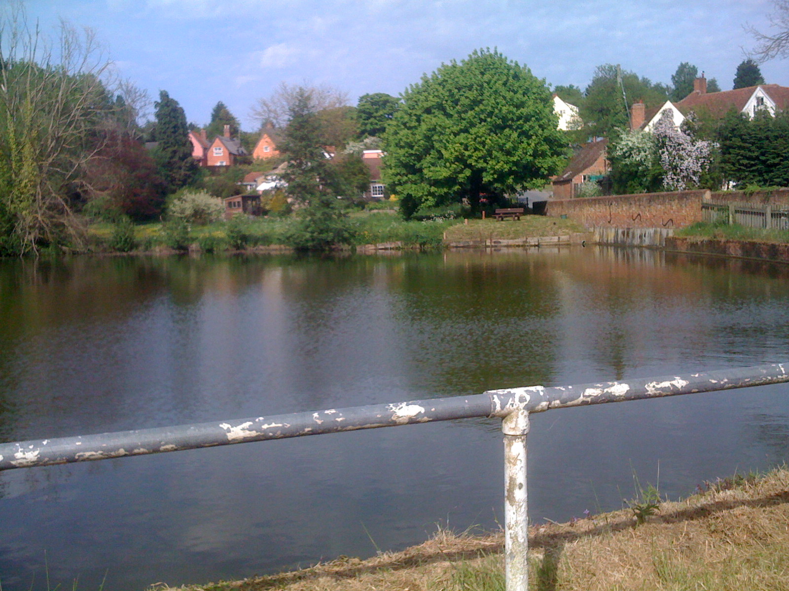
“This is England Guv” (nice railing)
Hair of the Dog
Posted by Neil in Jog Le Blog on May 8th, 2009
Went out yesterday for a 20 mile ride to basically have a bit of a stretch.
Both of us have had a fair few aches and I’ve been doing my best Frankenstein impression hobbling down the stairs of a morning.
Fortunately, the ride did the trick and today is the first ache-free day since the C2C (it’s either the ride that did it, or the steam roller just forgot to come and drive over me in the night).
Now the aches have gone what better thing to do than see if we can get them back? That’s why we are planning a 70 mile ride on Sunday (weather forecast is looking good).
We’re going to have a crack at doing the complete Painters Trail.
For anyone who’s curious:
The Painters Trail is set within a designated Area of Outstanding Natural Beauty. Using a mixture of mainly quiet roads, cycle paths and well-surfaced tracks, the main circular route starts from either Manningtree in Essex, or Sudbury in Suffolk. The full circuit is designed to take between two and three days to complete.
The trail includes the locations of many famous paintings by artists such as: Harry Becker, Thomas Churchyard, John Constable, Thomas Gainsborough, Tom Keating, Cedric Morris, Sir Alfred Munnings and John Nash.
I suspect it won’t look quite so naturally beautiful when I’m wheezing away hauling my sweaty carcus across The Hay Wain so apologies in advance to any photographers/artists hoping to capture any essence of serenity while we’re in the vicinity.
I cycled part of the Painters Trail last year and got lost (no surprise there - but this time I have GPS). I ended up doing far more miles than I intended and by the time I got back to the car I was in a pretty bad old state. There are very few places to buy drinks on the trail (as I discovered to my cost)……and when you do find somewhere my advice is to not buy a litre bottle of water and drink the lot straight down…….it’s just…………not good.
The evening of that ride I was planning on going to a concert, I was so knackered by the time it was over that I was in two minds whether to go - THAT is how bad I was (those of you that know me well enough will realise I must have been in a serious state). In the end I did go - fortunately it was a sit down affair.
This time round we are doing the whole trail - not a section of it - but we are way more prepared and there is no danger of a repeat dilemma for yours truly……….
……mainly because I’m not going to a concert Sunday night.
I’m going to concerts Monday and Tuesday…….which for those patrons seated on the right hand side of the monitor has been designated a no riding zone (you need to have visited a cinema over 20 years ago to get that joke).
The main ride is now only 3 weeks away.
We really should start to think about planning the route sometime soon.
Stiff as………a very stiff thing.
Posted by Neil in Jog Le Blog on May 6th, 2009
OK, well 2 days on from completing the ride and the limbs are still reminding us both that we did it - we’re going out tomorrow for a 20-30 mile ride to try and loosen up a bit.
More importantly, we are now set up to receive donations for Macmillan Cancer Support from anyone who would like to show they have (at least some) faith in us completing the JogLe.
Even if you don’t think we’ll complete it but think the blog is an amusing read, or even if you will just take pleasure in our inevitable suffering (hmm….that’s probably 99% of our audience) then please make a donation of a few quid.
Coast 2 Coast day 3
Posted by Neil in Jog Le Blog on May 4th, 2009
So, after a pretty substantial dinner (homemade tomato soup, lamb shank with minty gravy and CHIPS….a proper meal!) in Allenheads one and only pub (which was a bleeding mile walk…….as we went the wrong way), we settled down for the night in Mill Cottages (#3 - highly recommended).
I woke in the night a few times to the soothing sounds of raindrops thrashing the window pane.
We were being left in the capable hands of Liam, one of the sons of the guesthouse owners who were off to Norwich. The boy didn’t let us down at all with an awesome full English breakfast all ready and waiting for us when we hobbled down the stairs trying to work out which body parts hadn’t completely seized up.
Not content with fueling us up for the morning, Liam then prepares us both a packed lunch with sandwiches made (at his recommendation) with bread made by his Dad.
Then we were off on the final day, in the rain, up a hill. The waterproof jackets were on, the covers were over the panniers, the wind was introducing itself to our faces and the fingers were beginning to make enquiries about the possiblity of heading somewhere a bit warmer.
We knew there were 2 climbs ahead of us today, then a very nice long cruise down to the coast. We guessed that the ride wouldn’t be entirely void of a bit of bad weather, and were grateful it was today rather than days 1 or 2.
11:21
Almost finished the 2nd climb. Even the notes say you might want to get off and push!
Seriously, if I had a hang glider I could run down and take off. Pushing uphill was making the calf muscles burn a lot as it was so steep.
Wind and some rain - glad we packed waterproofs. Wish I had full fingered gloves though - over 1500ft the wind makes it uncomfortably cold.
11:45
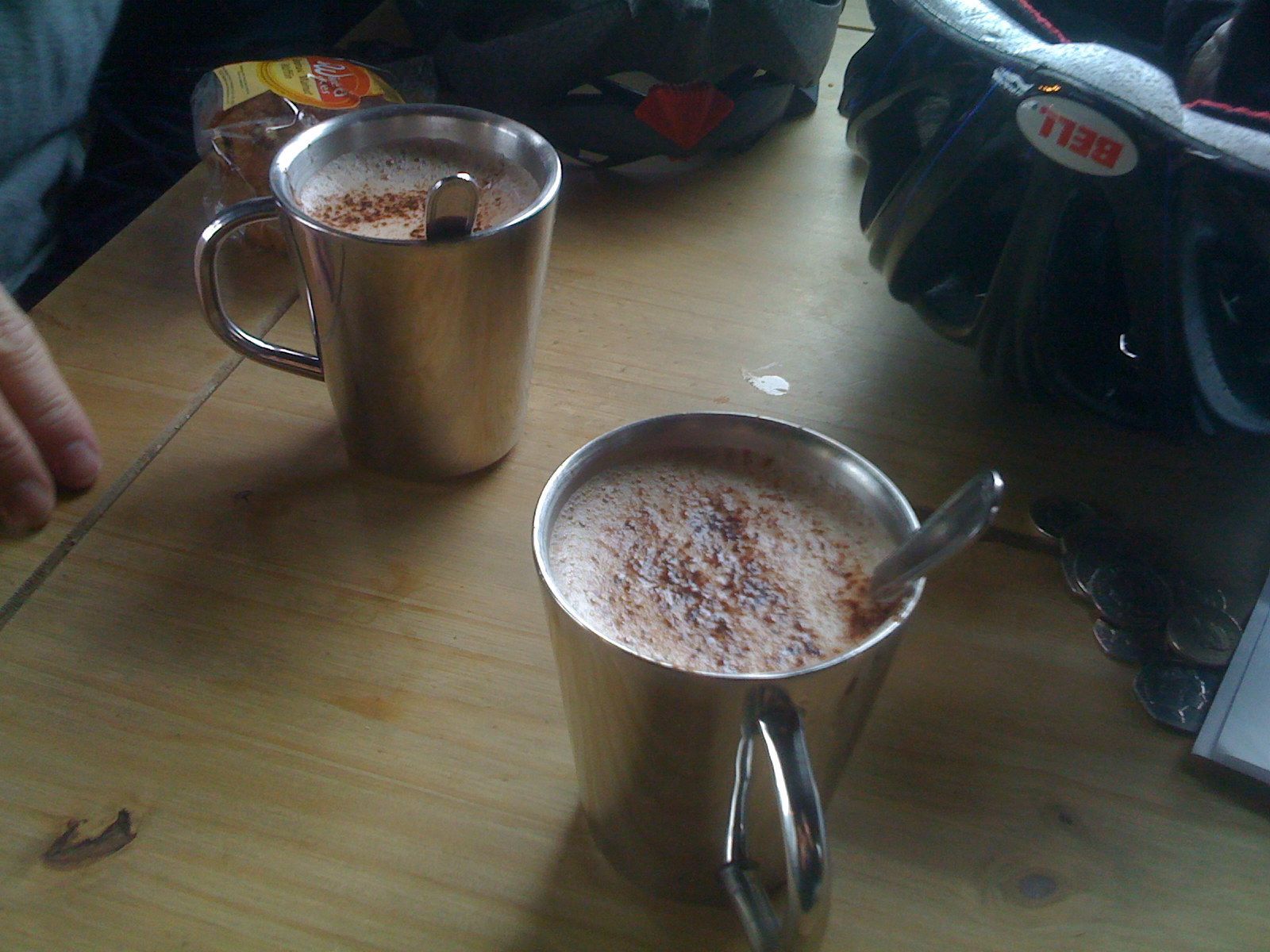
We’re out of the wind in a cafe at the top of the final hill. It should be downhill all the way now - and (hopefully) sheltered from the wind.
Cup hands here comes Cadburys
12:53
Lunch break courtesy of Liam (top lad) and his Dads homemade bread. It’s all downhill on a single track railway line. Still a bit windy but totally bearable.
17:31
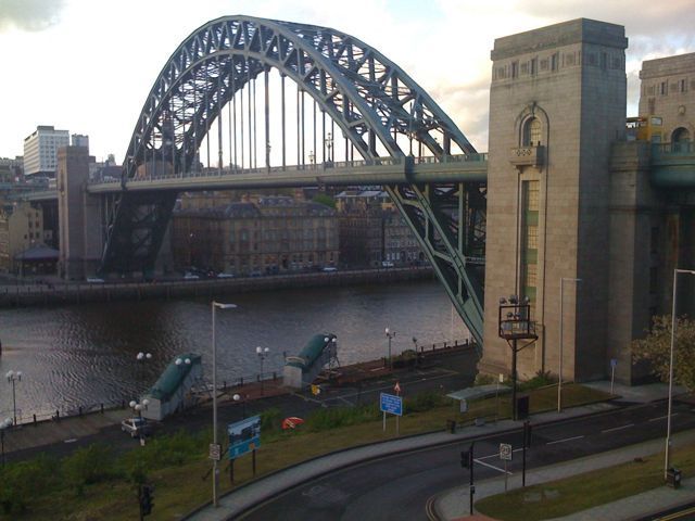
Made it in to Newcastle without any problems. Crossed the Millenium Bridge (photo opportunity taken) and followed the Tyne down to Tynemouth (no fog on it). Cycled a mile along the promenade to the official end point. Dipped front tyre in the water - photo taken.
Total distance cycled: 145 miles.
So what have we learnt from this venture?
Well, we now have a better understanding of what hills are and what they do to your legs.
We have a better appreciation of the importance of packing light (Pete more so than me).
We know that however fed up you feel while riding (or pushing) and start wondering why you’re doing it…….it’s only a matter of time before that feeling passes and it becomes enjoyable again.
And……..we know we’ve not been put off having a crack at the JogLe.
We’ve stirred up a fair bit of interest doing this ride, so for anyone contemplating having a go here are a few pointers:
Get in plenty of riding miles first. It’s pretty demanding in places and it’s not something you can attempt with no preparation. Think of when it’s London Marathon time and you see some of those ‘fun runners’ who have run less than half the course and look like they’re having anything but fun. We came across a few riders who had clearly let the beer do the talking and were now seriously regretting it.
Always have a drink to hand, and stop to drink at least hourly - even if you don’t think you need to. You can lose a lot of water sweating like a dog in a Chinese restaurant as you pedal out the miles. If you don’t replace it at the rate to lose it the headaches start, the energy drains……basically, the fun stops.
If you can eat them, take energy bars with you.
However, don’t get caught eating one when you encounter a hill. The thick, oaty blob in your mouth cannot be swallowed quickly. Once you start pedalling uphill the only thing you can do is leave it in the mouth where it will start to take on a vomit consistancy. You can’t spit it out, because it is pretty thick and gooey and you’ll run the risk of it landing on your clothing, making everyone else you encounter that day think you have thrown up on yourself and are a wuss. You can’t chew it because your mouth has stopped producing saliva as you work away at the hill.
It just sits there in your mouth waiting for phase 2 to kick in.
Phase 2 occurs when the effects of cycling uphill take hold - namely the heart starts working harder, damanding a faster rate of air intake. This is when you realise that by gulping down air you run the very real risk of sucking down the vomit-resembling blob that has been sitting in your mouth too long, but is too thick to swallow, and have it form a plug in your throat, and by doing so causing you to produce real vomit and confirming the thoughts that those cycling near you had been having for some time.
Take Sudocrem (or an equivalent) and use it. Mayonnaise on uncooked bacon rashers…..that’s all I’m saying.
Job done.
Coast 2 Coast day 2
Posted by Neil in Jog Le Blog on May 3rd, 2009
Total of route completed: 91 miles
Maximum speed: 33.8mph (Pete: 35.8mph)
Sudocrem: a friend for life.
The first thing to report is that there is actually a 4th flavour of hill:
The hill born out of wedlock.
After a very comfortable night courtesy of Freda and Colin at Makalolo (highly recommended), we shovelled down a full English breakfast and set off (not before being told we would have to do a lot of climbing today).
The first 10 miles or so were relatively straightforward. A few drops of rain but then the sun came out and pretty much stayed out all day.
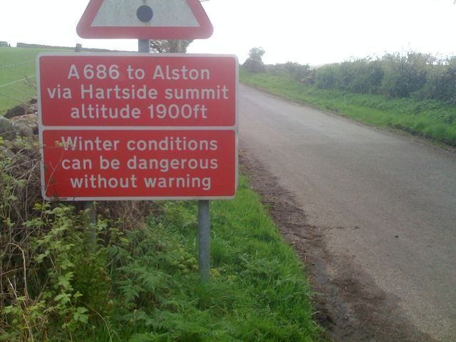
Starting off at a height of around 330 feet, the map showed us that the fun and games were going to start at Renwick and continue for the next 4 miles to Hartside at a height of around 1900 feet.
The notes described what was to follow as a “long climb”.
The author of these notes qualify to become the 3rd recipient of a hard punch in the face with no explanation.
There is no way I can describe just how brutal and exhausting this stretch of the route is.
There was a good number of cyclists tackling the climb (although the higher we got the more it thinned out). It didn’t take long for all the banter and chat to die away and for everybody to just get on with the task at hand in complete silence (apart from a lot of heavy breathing).
At around the 1500 ft mark I had to re-evaluate my opinion of the latex suited über cyclist with his carbon frame bike. These people appear silently from nowhere and go past you as if you are stationary.
When this happens I would often reflect on the high probability of them being (like todays new flavour of hill) born out of wedlock, and that anybody could go that fast and make it look that easy with no panniers and a super light bike. I would then tell myself that what we were doing was REAL biking.
This scenario could also be described as envy.
The situation on the climb to Hartside was the same but with one small difference.
As these multi-coloured stick insects flew past you while your wondering when the heart attack was going to hit, you would often hear cries of encouragement: “keep going mate”, “don’t let it get the better of you”, “it flattens out a bit up ahead, you’ve broken the back of it don’t give up”.
The boost this gives, and the help it provides cannot be explained.
We reached the top without stopping, or giving up, or walking.
There is a cafe at the top and it was packed with cyclists and motorcyclists. The queue for drinks and food was huge, and after only a few minutes the wind (no doubt refered to around here as a “a bit of a breeze” - even though it makes the trees grow at a 45 degree angle) was really beginning to bite and shivering came to pay a visit.
We decided to press on and stop further on, after all the next bit HAD to be downhill.
It was indeed downhill and we were able to roll at 30mph for the next 3 miles. The views were stunning and I’m convinced the road must have been used for filming something on Top Gear.
According to the notes the road “undulated” into Garragill.
What the author of the notes means here is not that the road will be something like rolling along the topside of a fluffy cloud, but rather you will plummet around 200 feet under full brakes, only to then have to climb back up at a snails pace with whatever you have left in the tank after dealing with the hill born out of wedlock. Then repeat the process several times.
That author has earnt himself a second punch to the face.
We arrive in Garragill and we’re both starving. Pete spots a board advertising bacon butties. The matter did not need to be discussed.
A well earned rest accompanied with homemade leek and potato soup, bread roll, bacon sandwich and drink was very well received.
Whilst eating I read the notes to see what was in store for the rest of the day:
“the road climbs steeply”
“when you reach the top of the climb”
“the road climbs steeply” (this is a different road)
“continue climbing”
Basically, the author of these notes needs to be hospitalized.
“the road climbs steeply” actually means get off and walk.
While walking we met up with David, a fellow bike pusher from Liverpool. He had become separated from his group of (by the sound of it) complete lunatics and had long given up on making it to Allenheads by 4:00 in time to watch the Everton game.
We continued the rest of the journey with David - it made a change having another person to moan to and be moaned at by.
The descent into Allenheads was quite steep. After one stretch we regrouped and I revealed I’d hit 33.8mph, to which Pete revealed he’d made 35.8 (putting his chin on the handlebars gave him the edge).
We could see Allenheads now and were on the final descent - my one chance to top Pete’s PB.
It was while making this attempt that I spotted the cattle grid 15 feet in front of me. As I’ve already explained the brakes can - at times - serve little or no purpose.
This was one such time.
They slowed me down so much that I was only doing 28mph (still seated mind) when I went over the grid.
We’re eating in about an hour - I’m still hopeful that they will have dropped back down by then.
Tomorrow is the last leg and it looks great - apart from 2 short small climbs it’s downhill all the way to Tynemouth. No doubt torrential rain and a constant headwind is in store.
When we finally get back to the car I’m tempted to drive back to Penrith and find some riders just finishing their first day. With a Norman Bates glint in my eye I would take great pleasure in telling them “of course, tomorrow is the day you’ll be doing some climbing”.
We’re going to need a bigger boat.
Coast 2 Coast day 1
Posted by Neil in Jog Le Blog on May 2nd, 2009
Distance covered: 57 miles.
Max speed: 30.3 mph.
Before I start: if you find yourself in this part of the country cycling and someone uses the term “small hill” then you should offer no explanation and just punch them.
Actually, don’t do that.
Punch them hard.
No, better still punch them hard in the face.
They are lying to you.
There are no small hills around here. The hills only come in 3 flavours:
Hills.
Bigger hills.
Even bigger hills.
Today has reminded me of being in San Francisco as I have been very warm.
The similarities end there.
We were picked up at the hotel at 8:00 this moning by Peter - our friendly driver - and taken on a 2.5 hour drive across to Whitehaven to start the ride.
Also on board were a slightly older couple also attempting the C2C but over 4 days.
Lightweights.
Or so we thought.
On arriving at the start point we where surprised to see just how many people where also starting today. There were easily 50 other cyclists preparing to start.
Whilst putting our panniers on the bikes an elderly chap came over and started talking to us.
He tells us that he rode the C2C three years ago WHEN HE WAS 80.
If we ever have the need to be put in our place by someone…………..well…….we’ve found our man.
After loading up and having a 20 second first ever ride with panniers - deciding that it’s dead easy and no different to riding without (more on this later) we went over to the proper start point to dip our rear wheels in the water for the obligatory photo.
We met 4 chaps in need of their photo being taken so favours were exchanged and we were off.
Now I have been fully expecting that somewhere along the way we would lose our way and have to do a bit of backtracking.
I didn’t think this would be in the first 400 yards though.
After sorting out this little blip and realizing there were actually blue signs showing the way we were off (again).
The first 10 miles or so are a doddle. A nice tarmac lane that was once a railway line lead us out of the town. Constantly climbing - but at such a gentle rate it lulls you into a false sense of security we begin to pat ourselves on the back for being so superbly prepared for this ride.
The first 15 miles roll by without too much incident. Then a couple of things become apparent:
Getting up slopes (not hills) actually feels like much harder work than normal (that’ll be the panniers).
When you come down a slope you don’t freewheel for very long at all (that’ll be the panniers).
When approaching a slope you need to change down far earlier than normal (spotting a pattern yet?).
We may very well both run our own businesses and be reasonably well educated, but unfortunately neither of us did the course on the bleeding obvious.
Then the slopes became hills (not small ones) and they just went on and on, all the time becoming steeper.
We were gaining height a quite an obscene rate - we might be a couple of idiots but we’re not (always) completely stupid. It was time to get off and walk.
One good thing about the C2C is that we’re finding none of that macho idiocy amongst other riders that you meet. Everybody is very encouraging and there is no stigma attached to getting off and pushing for a bit.
Pete has vowed to never complain about hills again. This is a promise I confidently predict will last less than 24 hours.
The scenary on this ride is something else. Literally every 3 or 4 minutes there is another picture postcard view to take a photo of (a photo that will never do justice to the view).
The thing about this ride is that you are getting to view points that cannot be accessed by car, only by walking (erm…..no thanks) or bike.
The scenary looks so much better when it isn’t accompanied by a pair of windscreen wipers and a tax disc. It’s also nice to take a photo and not having to try avoid getting the ice cream van in the frame (although when we did find one it was welcomed with open arms).
So even though the pair of us would whine and moan as we’d struggle up a hill. Minutes later we’d be in some remote spot taking a photo agreeing that it’s worth it.
Eventually we make it to Whinlatter Pass - some 1200 feet higher than our starting point.
If you ever find yourself here on a bike and someone tells you that the route down from the Pass to Keswick is “a bit steep” then they too must be punched hard in the face with no explanation.
They are not lying (underselling most definately) but they are witholding key information.
They should be telling you that if you fall on the descent the best you can hope for is a serious maiming with the majority of your body requiring a skin graft. If you fall on the “wrong side” well…….if you’re lucky tree trunks will slow down your rate of descent in a Homer Simpson stylee. More likely however, is that you will reach terminal velocity as you freefall several hundred feet to the welcoming hard surface (and Grim Reaper) below.
The descent is not steep. It is insanely steep, and is made up ENTIRELY of loose gravel and stones.
It’s somewhat disconcerting to go down with your brakes pulled so tight your hands hurt, only to find you are still travelling at 16.5 mph.
It does help you keep your mind focussed though - I’ll give it that.
So onwards (and upwards) we trekked - taking plenty of drink stops as it was so hot (and fortunately no wind at all).
Around late afternoon we see the 4 chaps from the wheel-dipping photos back in Whitehaven. This is a very nice encounter. Not because we have bumped into some familiar faces, but because here was proof that our pace was not so insanely bad we must clearly be a couple of retards who had bitten off more than they could chew.
I seemed to have the only phone with a 3G signal, and they wanted to know the football scores (oh the power).
The hours began to pass at a faster rate than the miles and it became apparent we were going to be going into the evening.
En-route we came across an Ice Cream van (yah!) and a stone circle (in that order and that quickly after each other).
The Circle couldn’t go unchecked. I had a strong urge to stand in the centre and strike a pose with an electric guitar. Regretably I hadn’t packed the Fender due to the size limitations of the pannier (also, if you think WiFi access is difficult to find round here just try finding a plug-in point to an amp).
At about 8.15 we finally arrive at Penrith (our destination). Time to find out where the guesthouse is. While digging out the map a taxi pulls alongside: “are you guys going to Makalolo?”
“no mate”
Had we bothered to familiarize ourselves with the name of the guesthouse our answer would have been different.
“can you tell us where Barco Avenue is?”
“did Peter drive you over from Newcastle this morning?”
“er………yes”
“oh right, it IS you two….they were starting to get a bit worried……carry on for about 4 minutes and it’s on your left”
He then did a U-turn and drove off - he had been looking for us.
Already, we were the talk of the town.
One lasagne and chips later and I’m now ready for a good nights sleep.
A few final points to sign off with:
Biological anecdote: no idea why but after about 20 miles my nose turns into a dripping tap. I’m confident it’s not swine flu as it’s been doing it since we’ve been doing 20+ mile rides.
The thing is I’ve now decided to just let the damn thing drip.
Not sure if this makes me more like a seasoned cyclist or a snotty 6 year old.
I’ve lost count of the number of times we’ve been told by people today (sometimes with a Norman Bates style glint in their eye): “you want to save yourselves for tomorrow…….that’s when you’re gonna have to climb up some big hills”. WHAT?!
Finally, I don’t want to go into details about the effects of spending a very long warm day in the saddle. Suffice to say that if today was made into a film, and it needed a soundtrack, then “Ring of Fire” by Johnny Cash would definately be on it.
Next stop Allenheads (where?)
Very pretty……..but which way do we go?!
Coast 2 Coast day 0
Posted by Neil in Jog Le Blog on May 1st, 2009
With this mornings news reporting that a swine flu case had now cropped up in Newcastle, where else would we possibly be heading for?
Tomorrow morning at 8:00 (sharp) we are being met in the foyer along with a bunch of other people with nothing better to do on Bank Holiday weekend, and being driven (along with our bikes) to Whitehaven on the West coast where we will begin the C2C ride back to the East coast.
We have chosen to do an organized ride, whereby we pay a friendly company to drive us to the start and take care of accommodation and mapping out the route for us.
They will also transport luggage from stop to stop for us as well, although we are not taking them up on the offer and will be riding with all our gear ‘on board’ in panniers.
There are 2 reasons for this: we want to use this ride as a dress rehearsal for the main ride at the end of the month and are yet to do any riding at all with loaded bags; we also want to look big and clever and make the other cyclists think we know what we’re doing.
So after a carbo loading evening consisting of steak & ale pie, mash, chips, ice cream, Stella……..and Corona (ok maybe not carbo loading but still a loading of sorts) I think I’ve prepared all I can (not including the full English breakfast tomorrow before we set off).
The weather forecast is good, so hopefully we have 3 enjoyable days ahead.
If it’s Friday this must be Newcastle.